Graduate students involved in the university’s geographic information systems (GIS) program worked with national agencies and nonprofits to evacuate families seeking asylum in Afghanistan.
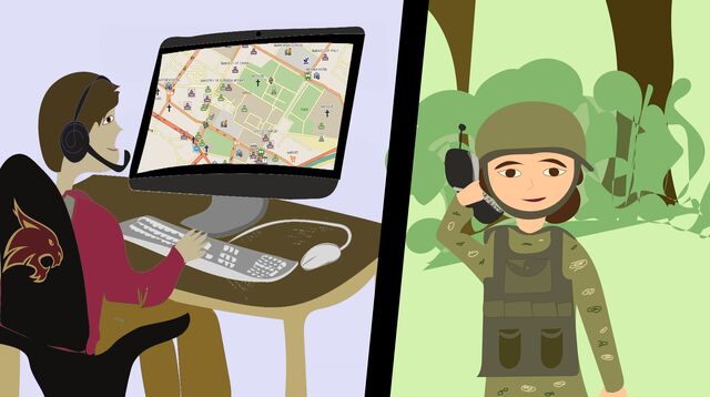
Students are assisting with an evacuation plan utilizing a satellite cartography system that captures, interprets and displays relative positions on the Earth’s surface. With GIS maps and careful communication, refugees are provided directions to a safe path out of the country.
Thousands of Afghans are seeking asylum after the Taliban took over Afghanistan and its major cities in August. The Taliban has displaced people from their homes and citizens are attempting to leave the country but fear retribution if caught.
Students assisting with the project are among other Americans. This movement of helping extract Afghan refugees has been coined Digital Dunkirk in reference to an allied rescue mission in World War II headed by civilians. The project started on Aug. 17 when Andrew Gardner, CEO of Riis Tech, a data science and artificial intelligence company, was invited to help by the U.S. Department of Defense.
Brittany Minnig, a Texas State geography graduate student, received a mass email from Gardner asking students with GIS experience to help. Minnig is currently a GIS intern with the City of San Marcos and wanted to assist in any way she could.
“Personally, I would find it very disheartening if I heard that somebody had the opportunity to help me, and they chose not to,” Minnig said. “It was important not only to just help save human lives but also from a moral standpoint for me.”
Gardner wanted Texas State GIS students to help due to their experience in GIS and his relationship with the university’s geography department. Students began working on the project on Aug. 29.
“[Texas State] students stepped up, within a half an hour we had 20 students and faculty members who had replied, and within an hour of that we were [all] on a phone,” Gardner said.
Other nonprofits, universities and related organizations in the technology field, such as Cisco, have also joined Digital Dunkirk to assist in the evacuation. Cisco played a crucial role during the beginning stages of Digital Dunkirk. The company created a database of 10,000 people inside Afghanistan that Cisco labeled as in need of help.
The people collected were required to provide personal information such as family photos and the International Mobile Equipment Identity number on their phone to determine and recognize its owner.
To analyze the mountains of digital data that was collected daily, Annie Hardy, Cisco senior experience design visioneer, reached out to local groups and organizations for assistance. Hardy contacted various organizations, such as Customer Partner Experience Engineering, Women of Cisco and a subgroup called Digital Experience as well as local colleagues in Austin. Shortly after reaching out, the new team members began reviewing data day and night.
“Within the next 48 hours we had 24/7 coverage on the inbox receiving emails from people, and as soon as we got them, we were sending them out an email that said, ‘we see you’,” Hardy said. “This is information this is what to do with your documents if you get captured. This is what to do with your phone, you need to wipe it completely. If you actually find safe passage, take it.”
While creating paths for refugees to exit out the country, the team realized additional expertise was needed. Despite the GIS maps being very accurate, dangers such as landslides and the Taliban are not always seen from a satellite. Gardner said any mistake could change the rest of theirs or someone else’s life.
“If you do your job wrong, you create a map and you send some woman and her children up the side of the mountain and they fall to their death or you lead them right in the path of people that want to kill them, you will have had your hand in that,” Gardner said. “That’s a burden, and a responsibility, you may have to carry for the rest of your [life].”
To help navigate the dangers of the project, a Green Beret named Joe was brought in. Joe has done numerous tours of Afghanistan and informed Gardner on the true difficulty of the task. He said the best chance they can give people is to direct them to follow goat trails.
“One chance you would actually have is, if you could find goat trails, because chances are, with satellite image you can identify a goat trail and then it would probably be something that a person could navigate,” Gardner said.
Minnig volunteered to clean masses of data files collected. Spreadsheets of unorganized information regarding people asking for evacuation out of the country would come across her desk, and her job was to organize the information.
“We were going through [spreadsheets] and standardizing everything, going through and making sure that it would be easily accessible for organizations that need the information,” Minnig said.
Minnig’s position decreased the amount of time it takes for people and families to get help. Minnig took the role out of moral feeling, claiming it was the right thing to do.
“After hearing about what was happening over there I felt like if I didn’t do something it would be like a detriment, I couldn’t ignore it if I knew I could help them,” Minnig said.
Categories:
Texas State graduate students aid Afghanistan refugees
Arthur Fairchild, News Reporter
October 15, 2021
0
Donate to The University Star
Your donation will support the student journalists of Texas State University. Your contribution will allow us to purchase equipment and cover our annual website hosting costs.
More to Discover


