
Students in Texas State’s Geographical Information System (GIS) program assisted the Civil Air Patrol (CAP) and the Federal Emergency Management Agency (FEMA) in mapping disaster zones caused by Hurricane Ida this September.
The students volunteered through the Civil Air Patrol’s Geospatial Program where they conducted imagery analysis of damaged structures using the FEMA Crowdsourced Damage Assessment app. As of now, Texas State students have assisted CAP in making a total of 196,712 assessments of possibly damaged structures
Capt. Scott Kaplan, National Program Manager for the CAP Geospatial Program, described the project as a volunteer opportunity that initially started with CAP members across the nation. Texas State students were offered the chance to work with CAP and FEMA after the organizations previously worked on a project mapping areas of Afghanistan with the students.
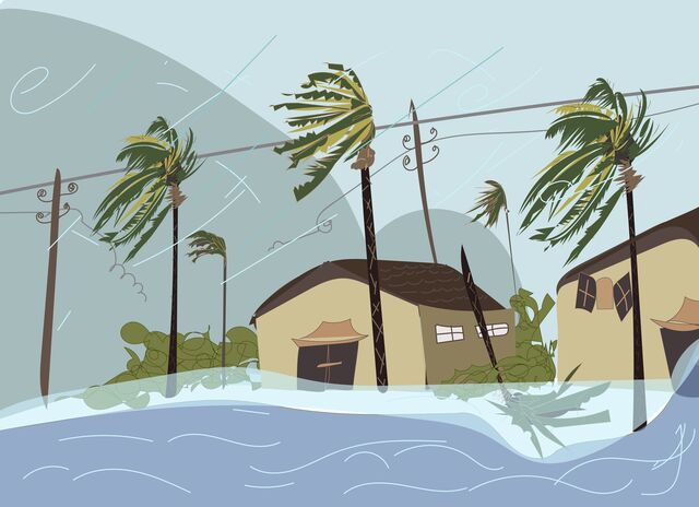
The project’s goal was to assess damaged structures caused by Hurricane Ida. FEMA asked CAP to determine the level of destruction initially determined by artificial intelligence. According to Kaplan, FEMA used the system to mark areas of destruction identified by sets of polygons surrounding a possible structure. The volunteer’s job was to examine the marked polygons to determine the amount of damage identified by the polygon.
“We need to classify the structures as destroyed, major, minor, affected, no visible damage or unknown,” Kaplan said. “Those are the classifications FEMA uses for classifying damage, but it requires [following] really strict guidelines. [An example is if] someone would [said] ‘a roof is missing, it’s destroyed,’ that’s actually [may] not a true statement, [it’s more likely] major damage. If there’s a hole in your roof it has to cover more than two-thirds of the roof to be classified as major, otherwise, it’s [considered] minor damage.”
Riley Brewer, a GIS senior, explained volunteers were emailed by FEMA support and given a link to Esri, an international supplier of geographic information system software used for web GIS and geodatabase management applications. Volunteers were then administered logins to the platform.
“We sent them the [volunteer] signup sheet which they used to create our login,” Brewer said. “Then in the link, we pulled up the page. From there we could access the web map that would have all the [airborne] imagery, and then FEMA created an activated grid that you could zoom into that was kind of just like a set area, geographical space.”
Volunteers had to indicate damage in different areas affected by the hurricane. Elena Shabalina, a GIS graduate student, was eager to help with the project after she heard about the volunteer opportunity.
“It is a unique opportunity because we work closely with the Air Force, and with government data and also the benefit was that people needed help,” Shabalina said. “I am an experienced GIS specialist. I couldn’t just miss this message, and I heard on the news that it was a catastrophe for people.”
Shabalina helped inspect hurricane damage in southern Louisiana during her time working on the project.
“Sometimes I’ve seen really horrible pictures, it was the house and after the hurricane, it just was something destroyed,” Shabalina said. “I realized that the more I help, the faster people can get the help and the faster they can do something with their dwellings because the images I’ve seen they’re just horrible.”
Brewer previously worked with CAP on another mapping project before being asked to work with Hurricane Ida. Brewer was intrigued by the type of damage a hurricane could create for different housing infrastructures, despite being in the same area.
“It was definitely crazy, invariable like every natural disaster would be,” Brewer said. “Definitely interesting to see how different roof types work because when you zoom in on this where you see one house, that is probably 5,060 feet from the other, and their roof is completely caved in and a person that had a barndominium is fine, their yard is just messed up. So, it’s definitely interesting and sometimes really sad to see the impact that it had on a lot of people’s homes and businesses.”
Nakky Ekeanyanwu, another GIS graduate student who helped with the project, was happy to receive experience and the chance to work with FEMA.
“I get to put it on my resume as volunteer experience, which I also feel looks really good,” Ekeanyanwu said. “I may not have worked there full time but what I did gave me some insight into how these guys function, how they work, what their goals are, what they’re into.”
The project consisted of volunteers from over 39 states. Kaplan explained many of the volunteers were cadets aged 12-18 and senior members 18 and older. CAP members from across the nation were looking to gain GIS experience and support a disaster response, such as the volunteers from Texas State.
Organizations including the American Red Cross, shelter and housing task forces and different sectors of FEMA will continue to use the data collected to estimate the cost of damages and determine where help is needed.
“Multiple groups are using the data that we [provided in their] response. We’re helping Louisiana, and that’s just incredible right now because [the organizations have a clear picture of] the most highly damaged areas [based on] the data that we gave,” Kaplan said.
The project was conducted over two weeks at the beginning of September. The amount of work done by Texas State students and CAP resulted in the largest crowdsourced event assessing damage for FEMA this year.
Correction: An earlier version of this article incorrectly identified Capt. Scott Kaplan as the CAP geospatial program manager and national volunteer. Kaplan is the National Program Manager for the CAP Geospatial Program. The article has also been changed with the help of Kaplan to accurately represent information from the Hurricane Ida Project.
Categories:
Texas State students map Hurricane Ida disaster zones with national, federal agencies
October 8, 2021
hurricane
More to Discover