

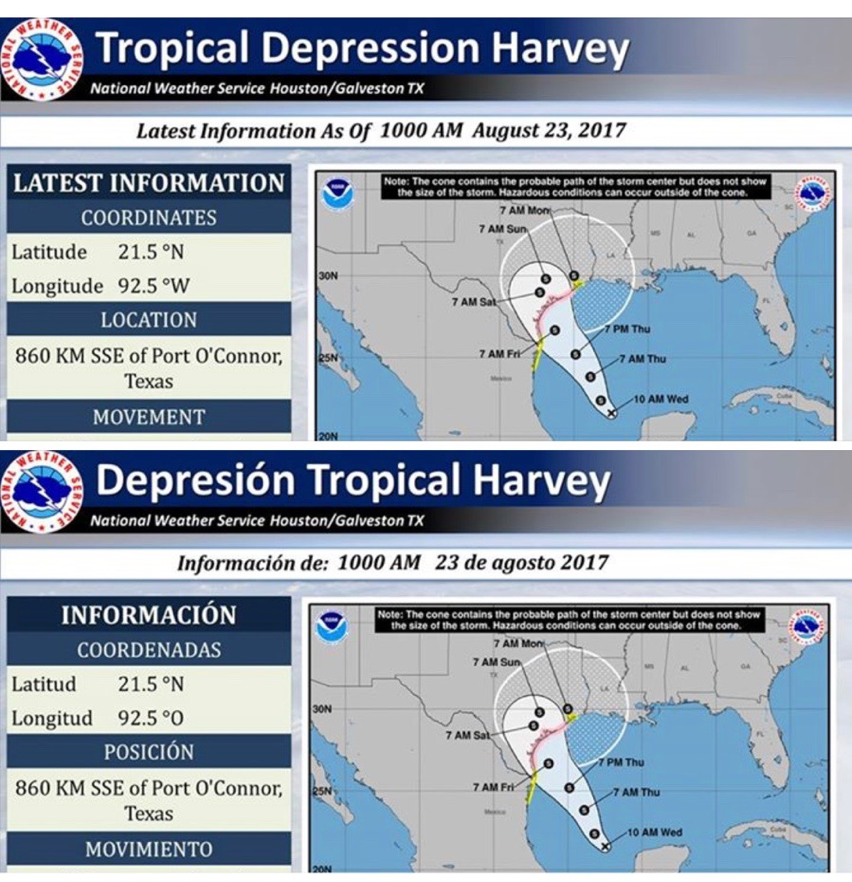
Hurricane Harvey, possibly a category 4 at landfall, is expected to travel throughout the weekend, causing accelerated winds and thunderstorms in the Hays County area, according to National Weather Service. The National Weather Service’s most current projected path for Harvey shows the storm entering the Gulf of Mexico and causing effects through out Texas.
The weather service predicts anywhere from 2-10 inches of rain in the Hays area.
Harvey is expected to impact the Texas coast Friday with severe flooding, storm surge, winds and surf, reported National Weather Service.
Areas most susceptible to damages from current storm projections are Lee County, Fayette County and Gonzales County, and those areas to the south and east of Caldwell County.
Heavy rainfall in Caldwell County, which borders Hays County, may lead to flooding in San Marcos
Martin Ritchey, emergency management coordinator of Caldwell County, said there is a potential for flooding depending on the rainfall.
“Right now, we are in a semi-drought and rivers are not flowing at full capacity,” Ritchey said. “So there is a lot of capacity to store any water that comes down. The biggest risk would be low-level flash flooding. However, if the system was to fall in a more extreme amount in a short period of time, we could see significant flooding.”
In addition to severe flooding and thunderstorms, Ritchey advises residents to watch out for other susceptible emergencies such as fires that can occur during storms.
“Tree lines and limbs that fall can actually cause fires. A lot of the underbrush in Hays and Caldwell is still so dry, giving dry grasses and leaf litter room to have fires caused by lightning and downed power lines,” Ritchey said.
Information of risk factors will be updated once the tropical storm begins to make its route.
“Listen to public officials, watch the news for updates,” Ritchey said. “We can’t minimize this or overblow it – we have to keep our senses.”
San Marcos residents can register cell phone numbers and email addresses to get alerts. Registration can be found at WarnCentralTexas. Or by calling (866)939-0911.
-
A file photo of a City of San Marcos sign.