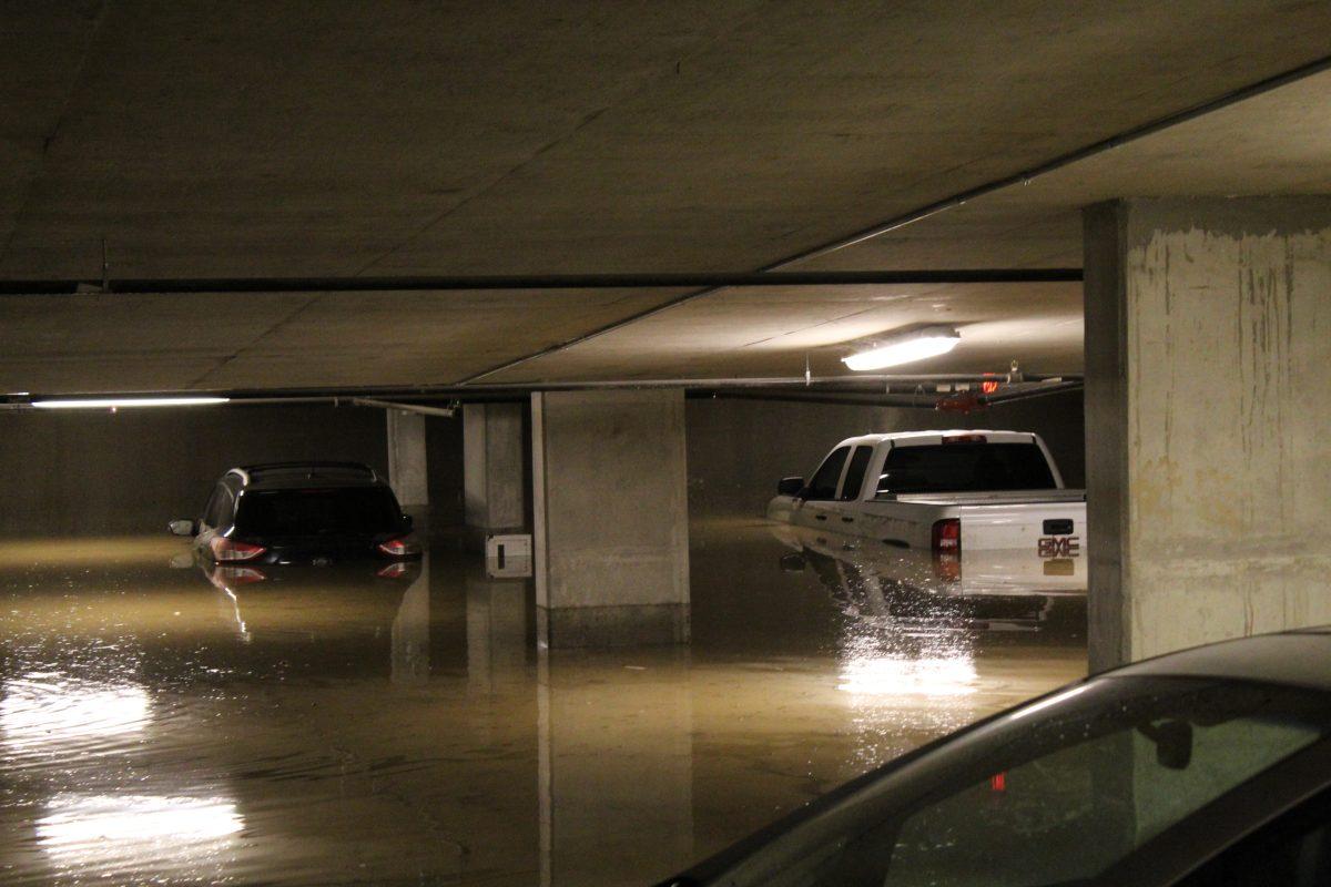
Vehicles in The Pointe apartment’s garage remain underwater after an overnight flood.
Thunder and lightning proceeded torrential rainfall through the morning and afternoon of March 28.
Shortly after midnight, lightning began to illuminate the sky followed by thunder. The rain began shortly after, alternating between a sprinkle and hard rainfall.
The National Weather Service issued a flash flood warning at 10:39 a.m. for the San Marcos area that is currently in effect until 1:30 p.m. A flash flood watch is in effect until 7 p.m.
Jason Runyen, a National Weather Service meteorologist, described the difference between a flash flood watch and flash flood warning.
“Flash flood watches are issued when conditions are favorable that flash flooding will occur, it doesn’t necessarily mean that they are occurring yet” Runyen said. “A flash flood warning means there’s actually ground proof that there’s flash flooding occurring or we see on doppler radar that it’s imminent.”
The National Weather Service offers updates on advisories, including flash flood watches and warnings. A map highlighting specific information about low water crossing closures is continuously updated by ATXfloods.
Heavy rainfall is expected to slow after 12 p.m. and continue to fall east of Interstate 35, followed by some expected light rainfall for the San Marcos area.